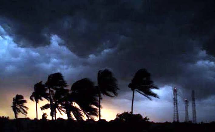
Bhubaneswar: The entire Odisha is drenched in the influence of Nor’wester as it brings thunderstorms and rains in various parts of the state. The worst impact of Nor’wester was seen in Northern Odisha on Wednesday.
Despite a slight increase in temperature compared to Tuesday, rainy winds and clouds were recorded in the state’s coastal area on Wednesday. The Indian Meteorological Department (IMD) expert Umashankar Das predicted, while the extent of rains will increase in the state by Thursday, there will be no significant change in the state’s weather over the next five days.
On the 9th, many areas are likely to experience rain and stormy winds, with wind speeds during the Nor’wester expected to reach 40-50 kmph. Heavy rain is anticipated in several districts, including Mayurbhanj, Angul, Balasore, Dhenkanal, and Jajpur. The IMD primarily forecasts, during the next five days, thundershowers, rain and stormy winds likely to occur in the coastal areas. Meanwhile, temperatures have dropped to 10°C in the twin cities of Bhubaneswar and Cuttack, while in the interior it has dropped to 15°C, added Das.
Now the people of the state can expect some relief from the heatwave, as there is no significant change in the state’s temperature predicted for the next five days. But s warning has been issued for rain with lightning until the 14th due to Nor’wester. Weather conditions from the coast to the interior are expected to be cloudy with thunderstorms in places, leading to a decrease in daytime temperatures.
On the other hand, westerly winds are active with airflow from sea to land on Tuesday and the low-pressure system has weakened on Wednesday. But a low-pressure system has emerged from the cyclone formed over North East Rajasthan, extending over 1.5 km from the landfall to South Assam, Uttar Pradesh, Jharkhand and West Bengal Ganges River. Therefore, the state is experiencing rain and cooler temperatures said the IMD.
Comments are closed.