
Bhubaneswar: A cyclonic circulation lies over Northeast Bay of Bengal & neighbourhood extending up to 5.8 km above mean sea level and under its influence, a low pressure area is likely to form over northwest & adjoining westcentral Bay of Bengal during the next 48 hours, informed the India Meteorological Department (IMD) on Sunday.
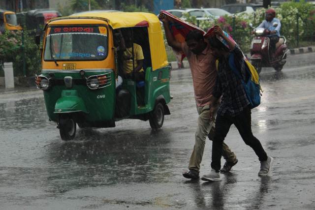
According to a special bulletin of Bhubaneswar Meteorological Centre, the current meteorological features indicate that fairly widespread to widespread light to moderate rainfall activity with isolated heavy to very heavy rainfall is very likely over Odisha during the next five days.
Also, thunderstorms with lightning activity are very likely during the next two days and it is advised to take safe shelter during thunderstorm activity to protect from lightning, the regional Met Centre said.
Weather Warning for the Next Five Days:
- Day-1: (Valid up to 08.30 AM of 04.09.23):
- Yellow Warning: Heavy to very heavy Rainfall (7 to 20cm) very likely to occur at isolated places over the districts of Angul, Dhenkanal, Kalahandi, Boudh, and Kandhamal.
- Heavy Rainfall (7 to 11cm) very likely to occur at isolated places over the districts of Balasore, Bhadrak, Jajpur, Keonjhar, Mayurbhanj, Cuttack, Sambalpur, Deogarh, Sonepur, Malkangiri, Koraput, Nawarangpur.
- Thunderstorm with lightning very likely to occur at isolated places over the districts of of Balasore, Bhadrak, Jajpur, Kendrapara, Cuttack, Jagatsinghpur, Keonjhar, Mayurbhanj, Sundargarh, Jharsuguda, Sambalpur, Deogarh, Bargarh, Angul, Dhenakanl, Puri, Khurda, Nayagarh, Ganjam, Kandhamal, Boudh, Malkangiri, Koraput, Nawarangpur, Kalahandi, Raygada and Sonepur.
- Day-2: (Valid from 08.30 AM of 04.09.2023 to 08.30 AM of 05.09.2023.):
- Yellow Warning: Heavy to very heavy Rainfall (7 to 20cm) very likely to occur at isolated places over the districts of Koraput, Kalahandi, Malkangiri, and Nawarangpur.
- Heavy Rainfall (7 to 11cm) very likely to occur at isolated places over the districts of Khordha, Puri, Cuttack, Dhenkanal, Keonjhar, Sambalpur, Angul, Sonepur, Boudh, Bargarh, Rayagada, Bolangir, Nuapada, Ganjam and Gajapati.
- Thunderstorm with lightning very likely to occur at isolated places over the districts of Balasore, Bhadrak, Jajpur, Kendrapara, Cuttack, Jagatsinghpur, Keonjhar, Mayurbhanj, Sundargarh, Jharsuguda, Sambalpur, Deogarh, Bargarh, Angul, Dhenakanl, Khurda, Puri, Nayagarh, Ganjam, Gajapati, Malkangiri, Koraput, Rayagada, Kandhamal, Kalahandi, Bolangir, Sonepur, and Boudh.
- Day-3: (Valid from 08.30 AM of 05.09.2023 to 08.30 AM of 06.09.2023)
- Yellow Warning: Heavy to very heavy rainfall (7 to 20cm) very likely to occur at isolated places over the districts of Malakangiri, Koraput and Nawarangpur.
- Heavy Rainfall (7 to 11cm) very likely to occur at isolated places over the districts of Gajapati, Ganjam, Rayagada, Nuapada, Kandhamal, Puri, Khordha and Kalahandi.
- Day-4: (Valid from 08.30 AM of 06.09.2023 to 08.30 AM of 07.09.2023)
- Yellow Warning: Heavy rainfall (7 to 11cm) very likely to occur at isolated places over the districts of Puri, Khordha, Nayagarh, Ganjam, Gajapati, Kandhamal, Kalahandi, Malkangiri, Rayagada, Koraput, Nawarangpur, Keonjhar and Mayurbhanj.
- Day-5: (Valid from 08.30 AM of 07.09.2023 to 08.30 AM of 08.09.2023)
- Yellow Warning: Heavy to very heavy rainfall (7 to 20cm) very likely to occur at isolated places over the districts of Nuapada, Kalahandi, Bargarh, Bolangir and Nawarangpur.
- Heavy Rainfall (7 to 11cm) very likely to occur at isolated places over the districts of Boudh, Sonepur, Koraput, Kandhamal, Rayagada, Gajapati, Ganjam, Sambalpur, Angul, and Nayagarh.
Comments are closed.