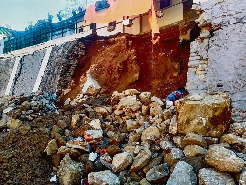
Dehradun: Concerns over land subsidence in Joshimath mounted on Friday as satellite images released by ISRO showed the Himalayan town sank 5.4 cm in 12 days while efforts to pull down an “unsafe” hotel that has developed cracks were in full swing.
Twenty-five more families were evacuated from subsidence-hit houses, taking the total number of such families to 185, according to the District Disaster Management Authority, Chamoli.
Chief Minister Pushkar Singh Dhami said the government’s biggest priority is to provide quick relief to the affected people and evacuate them to safety.
He chaired a cabinet meeting during which a slew of decisions, including a six-month waiver of water and electricity bills and a one-year moratorium on recovery of bank loans, were taken to provide succour to the affected people.
The Indian Space Research Organisation released satellite images of Joshimath showing that it sank 5.4 cm between December 27, 2022 and January 8, 2023, triggered by a possible subsidence event on January 2.
The preliminary study by ISRO’s National Remote Sensing Centre (NRSC) said the land subsidence was slow between April and November 2022, when Joshimath sank 8.9 cm.
The report said a subsidence zone resembling a generic landslide shape was identified – tapered top and fanning out at the base. It noted that the crown of the subsidence was located near Joshimath-Auli road at a height of 2,180 metres.
Police personnel were deployed in large numbers around Malari Inn hotel, which has developed large cracks and is tilting precariously towards adjacent Mount View hotel, as the demolition operation was underway.
The demolition is being carried out under the technical supervision of the Roorkee-based Central Building Research Institute, according to officials.
Comments are closed.