
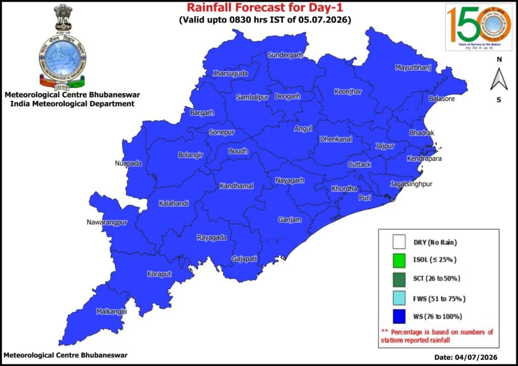
A well-marked low-pressure area over the northwest Bay of Bengal and adjoining Odisha–West Bengal coasts intensified on July 4, triggering widespread rainfall across Odisha.
The India Meteorological Department (IMD) forecasted heavy to very heavy showers until July 8, with alerts issued for several districts.
The system’s associated cyclonic circulation extends up to 7.6 km above sea level and tilts southwestward with height. Meteorologists expect the low pressure to strengthen further within the next two days and move west-northwestward toward north Odisha and Chhattisgarh.
On Saturday, IMD issued a red warning for five districts and an orange warning for eight districts, cautioning residents about intense rainfall. From Sunday, rainfall intensity may ease slightly, but northern and western Odisha districts will continue to experience heavy showers. Orange warnings were issued for Kendujhar, Mayurbhanj, and Sundaragada, while yellow warnings covered Baleshwar, Bhadrak, Kendrapada, Jajpur, Dhenkanal, Anugola, Baragada, Sambalpur, Jharsuguda, and Debagada.
Coastal regions, including Bhubaneswar, Kataka, Puri, and Jagatsinghpur, witnessed continuous rain since morning. IMD warned of squally winds reaching 50–60 kmph along the Odisha coast until July 7, advising fishermen to avoid venturing into the sea due to rough conditions.
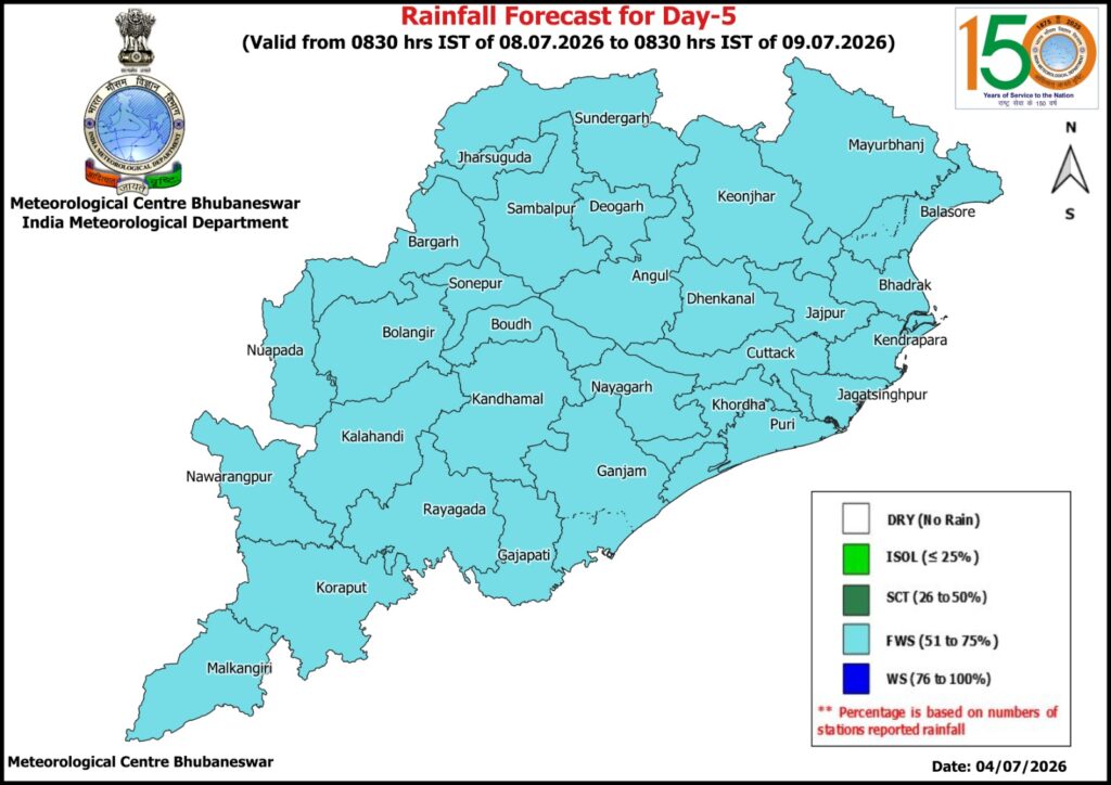
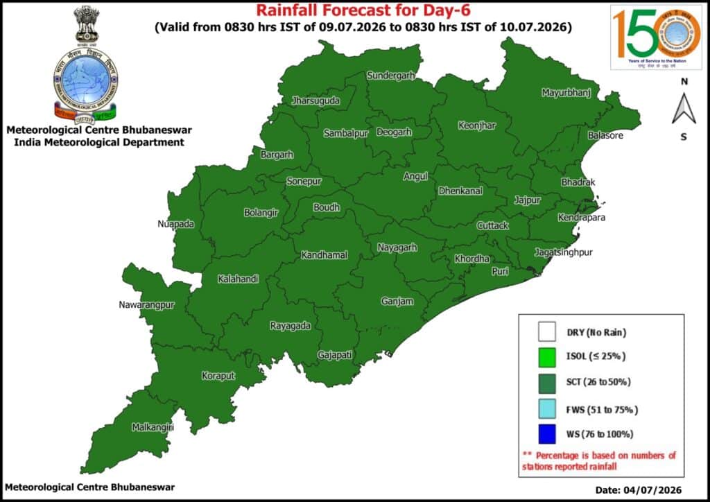
The rainfall is expected to support delayed Kharif sowing, though authorities urged caution in flood-prone and low-lying areas. The IMD’s seven-day forecast shows a gradual transition from widespread rainfall to isolated showers by July 11, signalling the weakening of the system as it moves inland.


