

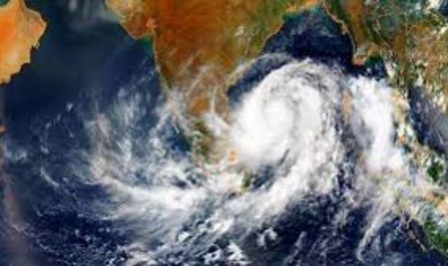
The Indian subcontinent is bracing for a complex weather pattern as twin meteorological systems dominate the Bay of Bengal.
While a localized low-pressure area continues to drench South India, meteorologists are closely tracking a fresh system moving in from the Andaman Sea that holds the potential for further intensification.
An upper air cyclonic circulation currently active over the Gulf of Thailand and adjoining Myanmar has expanded up to 5.8 km above sea level. This system entered the North Andaman Sea on the night of October 21.
According to the India Meteorological Department (IMD), it is projected to move west-northwestwards, leading to the formation of a new low-pressure area over the Southeast and adjoining East-central Bay of Bengal by October 23.
Weather scientist Surendranath Pasupalak noted that environmental conditions are highly favorable for this system to intensify significantly by October 26. Global forecasts align with this concern; the US National Oceanic and Atmospheric Administration (NOAA) issued a Global Tropical Hazards Outlook on October 20, indicating a 60% probability of tropical cyclone formation in the region next week. The active Madden-Julian Oscillation (MJO) over the Indian Ocean is providing a conducive environment for this development, a projection supported by European weather models.
Despite the heightened probability, the IMD maintains that it is too early to officially declare a cyclone or pinpoint landfall. While initial assessments suggest the system will track west-northwest or northwest before recurving toward the Andhra Pradesh and Odisha coasts, its exact trajectory will heavily depend on the positioning of the sub-tropical ridge and incoming upper-air troughs. The next three days remain critical for mapping the system’s exact path and intensity.
In preparation, the IMD has warned that rainfall will increase across coastal Odisha between October 26 and 29. A Yellow Warning has been issued for October 26, predicting thunderstorms and gusty winds for Balasore, Bhadrak, Jajpur, Kendrapara, Cuttack, Jagatsinghpur, Puri, Khordha, Nayagarh, Ganjam, and Gajapati districts.
Meanwhile, the existing low-pressure area over the Southwest Bay of Bengal near the Tamil Nadu coast remains active. Over the past 24 hours, it has triggered extremely heavy rainfall (12 to 20 cm) across Tamil Nadu and Kerala, alongside heavy spells in Rayalaseema.
The severe weather has led to significant waterlogging and prompted school closures in several districts, including Chennai. Heavy to very heavy rainfall warnings remain active for Tamil Nadu, Puducherry, Karaikal, and Kerala through October 25, with localized heavy showers forecasted for Lakshadweep, South Interior Karnataka, and Coastal Andhra Pradesh. Fishermen across the impacted regions have been strictly advised to exercise caution and avoid venturing into the sea.