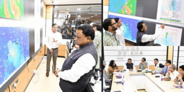


Regional Meteorological Centre issues Yellow Alert for select districts while forecasting a subtle cooling trend across Odisha.
Dry weather has largely prevailed across Odisha over the past 24 hours, with only isolated pockets recording light to moderate rainfall. However, a developing weather system is set to bring scattered rains, thunderstorm warnings, and a slight cooling trend to the state over the coming week.
According to Dr Sanjeeb Dwivedi, a senior scientist at the Regional Meteorological Centre in Bhubaneswar, Patrapur in Ganjam district recorded the highest rainfall at 9 mm, followed by Baleshwar with 4 mm and two other locations registering 1.6 mm.
Daytime temperatures have been steadily rising under clear skies. Puri recorded the state’s highest daytime temperature at 35.8°C, while Phulbani registered the lowest night temperature at 18°C. In the twin cities, Bhubaneswar and Kataka recorded daytime temperatures near 35°C, with night temperatures dropping to around 25°C and 23°C, respectively.
Weather Trough and District Forecast
An atmospheric trough stretching from North-East Bihar to the North-West Bay of Bengal—passing over Jharkhand and Gangetic West Bengal at an altitude of 0.9 km above sea level—is currently influencing the state’s weather pattern.
-
October 5–6: Light to moderate rain is expected in isolated places across Mayurbhanj, Nabarangpur, Rayagada, Koraput, Malkangiri, and Sundaragada. Most other regions will remain predominantly dry with no active weather warnings.
-
October 7: Rainfall activity is projected to increase. Districts including Sundaragada, Mayurbhanj, Kendujhar, and coastal Odisha are likely to experience lightning, light to moderate showers, and gusty winds reaching speeds of 30–40 km/h. A Yellow Alert has been issued for these areas.
-
October 8: Scattered rain accompanied by lightning and wind speeds up to 30–40 km/h will continue under a Yellow Alert in Sundaragada, Mayurbhanj, Kendujhar, Debagada, Anugola, Dhenkanal, and northern coastal districts.
-
October 9–10: No warnings are active for these dates, though light, isolated rainfall may occur in coastal Odisha, Mayurbhanj, and Kendujhar.
Temperature Dip Expected
Daytime temperatures are not expected to change significantly over the next 3 to 4 days. However, as cloud cover and rainfall increase, maximum temperatures are forecasted to drop by 2°C to 3°C across several regions. Night temperatures will remain stable over the next 6 to 7 days.
While officials state there is no major concern regarding heavy downpours, Dr Dwivedi advised residents to remain cautious during severe weather events, particularly during instances of lightning and thunder.