A violent thundersquall struck Uttar Pradesh on May 13, killing over 100 people across five districts.
Homes collapsed, trees uprooted, and mobile networks failed in several tehsils. Chief Minister Yogi Adityanath announced immediate compensation and warned officials against negligence in relief work.
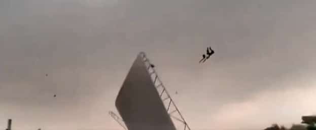
The storm’s ferocity shocked residents. A thundersquall is a fast-moving convective storm driven by extreme heat at the surface and cooler air above. In May, north India’s plains often exceed 40°C. Superheated air rises rapidly, pulling in cooler, moisture-laden air. This collision creates towering cumulonimbus clouds, which produce lightning, hail, and gale-force winds. When these clouds collapse, cold downdrafts slam into the ground, spreading outward at tremendous speed. Dust storms, locally called andhi, form as soil lifts into the air, reducing visibility to near zero.
The India Meteorological Department identified a Western Disturbance over North Pakistan and Jammu, along with a cyclonic circulation over Haryana and northwest Uttar Pradesh, as triggers. Western Disturbances are extratropical storms originating over the Mediterranean. They carry moisture eastward and often spark severe pre-monsoon weather across north India.
The atmosphere was primed before the storm. IMD recorded squally winds between 50 and 100 km/h in Uttar Pradesh within 24 hours of the event. During March to May, intense heating over northwest India fuels high convective activity. Without the stabilising monsoon, dry air, loose soil, and steep temperature gradients combine to create lethal conditions.


