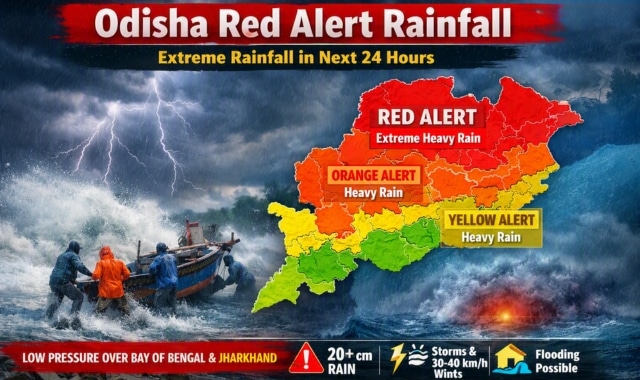
The India Meteorological Department (IMD) has issued a Red Alert for Odisha, warning of extreme rainfall within the next 24 hours.
Several districts are expected to receive more than 20 cm of rain, driven by a low-pressure system over the northwest Bay of Bengal and adjoining coastal regions.
According to IMD, the system is likely to intensify further as it moves northward, aided by an active low-pressure zone over southeast Jharkhand and the monsoon trough line. This combined effect will trigger widespread rainfall across Odisha.
Warnings for August 16:
- Orange Alert: Baleswar, Mayurbhanj, Keonjhar (heavy to very heavy rain).
- Yellow Alert: Kendrapada, Bhadrak, Jajpur, Kataka, Dhenkanal, Anugola, Debagada, Sundaragada (heavy rain likely).
- Statewide: Thunderstorms with lightning and gusty winds at 30–40 km/h.
Forecast for August 17:
- Red Alert: Baleshwar, Mayurbhanj (extreme heavy rainfall).
- Orange Alert: Kendujhar, Bhadrak, Dhenkanal, Jajpur, Kendrapada, Kataka (heavy to very heavy rain).
- Yellow Alert: Jagatsinghpur, Khordha, Nayagada, Boudhagada, Anugola, Debagada, Sambalpur, Sonepur, Bargada, Jharsuguda, Sundaragada (heavy rain expected).
IMD maps place Odisha firmly in the Red Zone for Day 1, with rainfall activity predicted to continue for several days.
Precautionary Measures:
- Low-lying areas may face waterlogging and localised flooding.
- Residents are advised to avoid open spaces during lightning and not seek shelter under trees.
- Fishermen have been warned against venturing into the sea until August 18 due to rough conditions.
- Rising river levels may pose risks to vulnerable communities.