
With a deep depression over the Bay of Bengal rapidly intensifying into a cyclonic storm and threatening widespread rain and gusty winds across Odisha, the state government has stepped up its disaster response machinery.
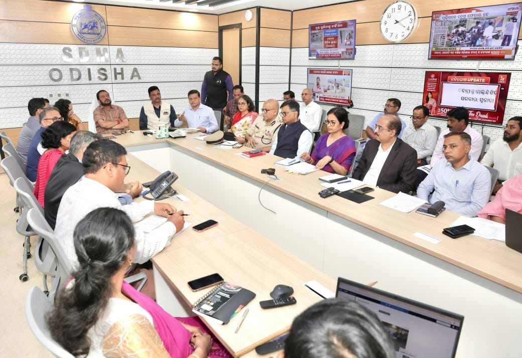
Revenue and Disaster Management Minister Suresh Pujari chaired a high-level review meeting at the State Emergency Operation Centre (SEOC) in Bhubaneswar on Monday, directing all departments and district administrations to ensure full preparedness by November 17.
Attended by the Chief Secretary and senior officials across key departments, the meeting assessed the latest India Meteorological Department (IMD) bulletins alongside ground-level readiness for rescue, relief, and evacuation. Emphasising that saving lives remains the government’s highest priority, Minister Pujari urged seamless inter-departmental coordination and proactive precautionary measures.
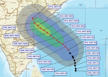
Cyclone Trajectory & Rainfall Forecast
According to IMD Bhubaneswar, the deep depression over the southeast and adjoining southwest Bay of Bengal has intensified into a cyclonic storm as of Monday evening. It is projected to strengthen into a Severe Cyclonic Storm by the evening of November 17 and further into a Very Severe Cyclonic Storm before making landfall along the Andhra Pradesh and Yanam coasts—between Nellore and Tuni—around noon on November 20, packing sustained wind speeds of 120–130 kmph and gusts up to 145 kmph.
While the landfall is projected south of Odisha, the state faces significant peripheral impacts:
- Nov 18–19: Heavy to very heavy rainfall, accompanied by thunderstorms and gusty winds, is expected across southern and coastal districts including Ganjam, Gajapati, and Puri.
- Nov 20: Widespread rainfall across all districts, with very heavy downpours forecast in Ganjam, Gajapati, Rayagada, Koraput, and Malkangiri.
- Nov 21: Heavy to very heavy rainfall likely in pockets of Sundaragada, Jharsuguda, Nuapada, and Koraput.
74 Rescue Teams & Landslide Precautions
To ensure rapid response, the state has finalised the pre-deployment of 74 specialised rescue teams—60 from ODRAF and 14 from NDRF—across vulnerable districts such as Ganjam, Gajapati, Kandhamal, Rayagada, Koraput, Malkangiri, and Puri. Fire Services units have also been placed on high alert with boats, lighting equipment, and rescue gear.

Highlighting the heightened risk of landslides in hilly terrains, the Minister instructed officials to expedite the evacuation of residents from identified landslide-prone zones and appealed to the public to cooperate with local administrations during relocations.
Key Directives Across Departments
- Shelters & Vulnerable Groups: District Collectors in high-risk districts have been told to keep District Emergency Operation Centres (DEOCs) operational 24/7. Officials are mapping vulnerable populations—including children, senior citizens, persons with disabilities, and pregnant women—and verifying drinking water, sanitation, power, and generator backups at cyclone shelters by November 17.
- Water & Infrastructure: The Water Resources Department is monitoring reservoir inflows, river levels, and weak embankments. Road maintenance teams equipped with earthmovers and tree-cutters are on standby to clear blocked routes, bridges, and ghat roads.
- Essential Supplies & Health: Food Supplies and Panchayati Raj departments have been tasked with stocking adequate dry rations, drinking water, and fuel. Hospitals have been directed to verify backup power, oxygen supplies, and ambulance readiness.
- Power, Telecom & Agriculture: Energy and telecom authorities are preparing rapid-repair crews to safeguard critical infrastructure and maintain uninterrupted power to hospitals and control rooms. The Agriculture Department is issuing crop advisories and arranging fodder and safe shelters for livestock.
- Fishermen Warning & Early Alerts: With sea conditions expected to remain rough to very rough from November 18 to the morning of November 20, fishermen have been strictly advised against venturing into the sea, and the Marine Police and Coast Guard are coordinating the safe return of vessels already at sea. Early warnings are being disseminated rapidly via SATARK, EWDS sirens, SMS, and media channels.