

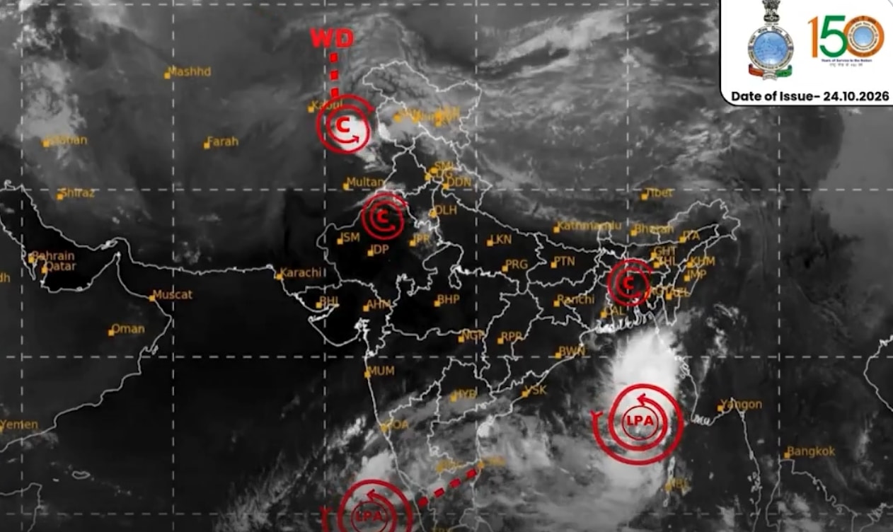
The India Meteorological Department (IMD) has issued a Pre-Cyclone Watch (Yellow Message) for Andhra Pradesh and adjoining South Odisha coasts following the formation of a depression over the Eastcentral and adjoining Southeast Bay of Bengal.
According to the latest bulletin, the well-marked low-pressure area has concentrated into a depression. It was centered near Latitude 15.8°N and Longitude 90.7°E—approximately 510 km north-northwest of Sri Vijaya Puram (Andaman Islands), 820 km east-southeast of Visakhapatnam, and 910 km east-southeast of Kakinada.
Projected Track and Intensification
The weather system is expected to undergo significant intensification over the next several days:
- October 25: Move nearly southwards, intensify into a Deep Depression, and gradually recurve west-northwestwards over the Eastcentral and adjoining Southeast Bay of Bengal.
- October 26 (Morning): Further intensify into a Cyclonic Storm over the Eastcentral and adjoining Westcentral Bay of Bengal.
- October 27 (Morning): Reach the strength of a Severe Cyclonic Storm over the Westcentral Bay of Bengal.
- October 28 (Morning): Intensify into a Very Severe Cyclonic Storm as it nears the Westcentral Bay of Bengal off the Andhra Pradesh coast.
Expected Landfall and Impact
The IMD forecasts that the system will cross the Andhra Pradesh and Yanam coasts between Bapatla and Visakhapatnam as a Very Severe Cyclonic Storm by the forenoon of October 28, 2026. At the time of landfall, maximum sustained wind speeds are expected to reach 115–125 kmph, gusting up to 140 kmph.
Local authorities across Coastal Andhra Pradesh and South Odisha have been advised to monitor updates closely and initiate precautionary measures in coastal districts ahead of the storm’s arrival.