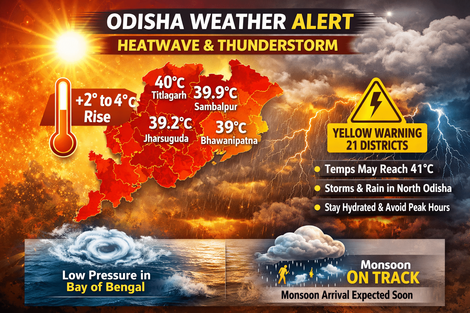
Odisha will experience a rise of 2 to 4 degrees Celsius in daytime temperatures over the next six to seven days, according to the India Meteorological Department (IMD).
The regional weather office confirmed that the low-pressure area over the southwest Bay of Bengal is unlikely to intensify into a depression, though it may evolve into a well-marked low-pressure system within 48 hours.
Western Odisha reeled under severe heat on Tuesday. Titlagarh recorded 40°C, Sambalpur 39.9°C, Jharsuguda 39.2°C, and Bhawanipatna 39°C. IMD predicted that on Wednesday and Thursday, most places in western Odisha will hover around 40°C. Coastal districts will remain relatively cooler, with maximum temperatures between 35°C and 38°C. By May 15 and 16, western and interior districts may touch 41°C, while coastal and southern Odisha will stay below 40°C.
Northern Odisha is likely to witness thunderstorms with rain until May 16. The IMD issued a yellow warning for 21 districts, cautioning about thunderstorms accompanied by lightning and wind speeds of 30–50 km per hour. On Tuesday, 13 districts already faced similar alerts. Officials advised residents, especially in western and interior regions, to stay hydrated, avoid outdoor activities during peak hours, and monitor weather updates.
Meteorologists noted that conditions remain favourable for the southwest monsoon to advance on time. The weakening low-pressure system over the Bay of Bengal supports monsoon progress, with forecasts suggesting arrival during the usual period in May’s second week. While no cyclone threat looms over Odisha, Kalbaisakhi-induced rainfall will continue in parts of the state.


