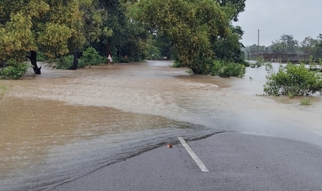
Torrential downpours across Malkangiri district have triggered rapid rises in river water levels, submerging several vital bridges and crippling normal life.
Floodwaters overflowing multiple transit points have completely severed road communications between the district headquarters and two major blocks—Kalimela and Podia.
Submerged Bridges and Blocked National Highway
Rising floodwaters have overwhelmed several key bridges across the region, creating severe travel hazards:
-
Poteru Bridge: 2 feet of water flowing above the deck.
-
Kangurukonda Bridge: Submerged under 6 to 7 feet of floodwater.
-
NH-326 (In front of Poteru Nursery): Covered with 2 feet of water.
-
MV-96 Bridge: Inundated under 3 feet of water.
-
MV-90 Gubile Bridge: Overflowing with 3 to 4 feet of water.
-
Kanya Ashram Bridge (Kalimela-Podia link): Submerged under 2 to 3 feet of rushing water.
Consequently, movement along National Highway 326—a crucial economic corridor connecting Vijayawada and Ranchi—has come to a complete standstill. Long queues of freight trucks, trailers, and passenger vehicles remain stranded near the flooded bridges, unable to proceed to their destinations.
The severe inundation on NH-326 has isolated multiple border villages and regional hubs. Connectivity to Kalimela and Podia blocks, alongside interior settlements including MV-90, MV-72, MV-79, MPV-81, MV-88, Maharazpalli, Pusuguda, and the border town of Motu, remains entirely cut off.
Beyond transit disruptions, low-lying agricultural lands have sustained extensive damage. Inundated paddy and sesame crops across vast agricultural tracts remain submerged, pointing to heavy losses for local farmers.
To prevent casualties and hazardous river crossings, local police personnel have been deployed on both sides of the submerged bridges. Authorities have barricaded the danger zones using red ribbons and are maintaining strict vigilance to warn commuters and keep citizens away from the fast-flowing floodwaters.