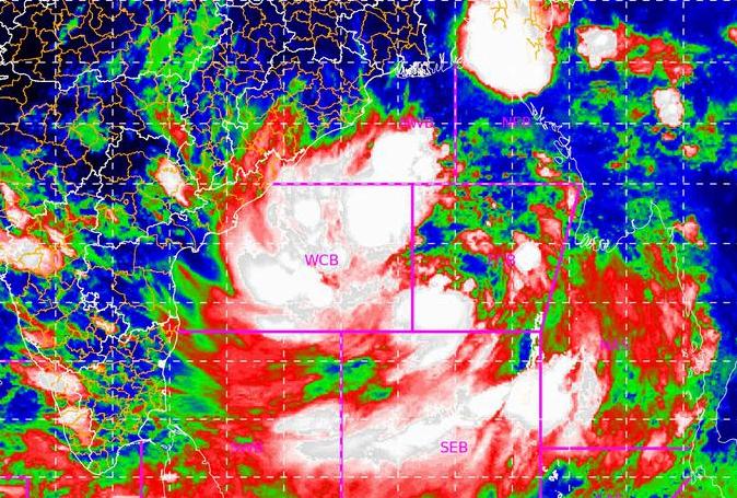
Bhubaneswar: The Depression over eastcentral Bay of Bengal is very likely to intensify into a Cyclonic Storm by the morning of May 24th and further into a Very Severe Cyclonic Storm during the subsequent 24 hours, the Bhubaneswar Meteorological Centre said late on Sunday.
“It would continue to move north-northwestwards, intensify further and reach Northwest Bay of Bengal near north Odisha and West Bengal coasts by 26th May morning. It is very likely to cross north Odisha – West Bengal coasts between Paradip and Sagar Islands by the evening of 26th May as a Very Severe Cyclonic Storm,” the India Meteorological Centre informed in its latest bulletin.
Light to moderate rain or thundershower very likely to occur at most places over the districts of coastal Odisha, at many places over the districts of north interior Odisha & at a few places over the districts of south interior Odisha between 8.30 am of May 25 and 8.30 am of May 26, 2021
Yellow Warning: Heavy to very heavy rainfall very likely to occur at isolated places over the districts of Balasore, Bhadrak, Jajpur, Kendrapada, Jagatsinghpur, Cuttack, Puri, Khurdha and Heavy rainfall at isolated places over the districts of Mayurbhanj, Dhenkanal, and Ganjam.
Light to moderate rain or thundershower very likely to occur at most places over the districts of north Odisha, at a few over the districts of south Odisha between 08.30 am of May 26 and 08.30 am of May 27, 2021.
Red Warning (Take Action): Heavy to very heavy rainfall very likely to occur at a few places over the districts of Balasore, Bhadrak Jajpur, Kendrapada, Jagatsinghpur, Cuttack, Mayurbhanj, and Keonjhar with isolated extremely heavy rainfall over the districts of Mayurbhanj, Balasore, Bhadrak and Kendrapada.
Squally wind speed reaching 40-50 kmph gusting 60 kmph is very likely to prevail over North Bay of Bengal and along and off Odisha – West Bengal coasts from 24th evening. It would increase gradually becoming 50-60 kmph gusting to 70 kmph from 25th evening. It would further increase becoming gale wind speed 60-70 kmph gusting to 80 kmph from 26th early hours over northwest Bay of Bengal and along and off West Bengal & north Odisha coasts. It would gradually increase further becoming 90-100 gusting to 110 kmph from 26th morning and increase thereafter becoming 155-165 kmph gusting to 185 kmph at the time of landfall till 26th afternoon.
Sea conditions will be rough to very rough over Andaman Sea & adjoining eastcentral Bay of Bengal on 23rd & 24th May, High to very High / Phenomenal over major parts of central Bay of Bengal, north Bay of Bengal and along & off Odisha – West Bengal coasts during 24th – 26th May.
The fishermen are advised not to venture into deep sea area of central Bay of Bengal from 23rd – 25th May and into North Bay of Bengal along & off Odisha coast from 24th – 27th May, 2021. Fishermen, those who are out in the Deep Sea are advised to return to the coast by today, 23rd May, 2021.
The Met Centre here has directed to keep hoisted Distance cautionary signal No.1 (DC1) in all ports of Odisha.


