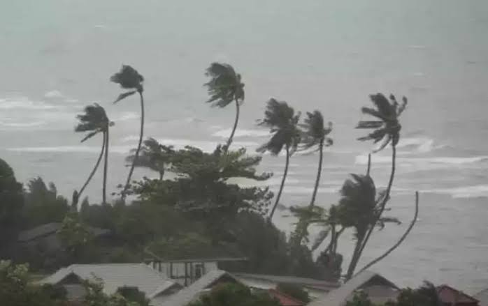
A well-marked low-pressure system over southern Bangladesh and adjoining Gangetic West Bengal has intensified into a depression, triggering a red alert across Odisha.
The India Meteorological Department (IMD) anticipates rainfall exceeding 21 cm at isolated locations over the next 24 hours.
According to weather scientist Umashankar Das, the system became more active at 5:30 AM today, escalating severe weather conditions across the coastal and northern belts of the state. Districts including Bhadrak, Jajpur, Dhenkanal, Angul, and Keonjhar have already reported widespread showers, confirmed by Paradip radar surveillance.
The IMD’s advisory warns of flash floods, waterlogging, and strong winds, particularly in low-lying and vulnerable regions. The compounded influence of another low-pressure zone over northwest Madhya Pradesh and the Bay of Bengal has intensified rainfall activity in Odisha.
The Regional Meteorological Centre in Bhubaneswar predicts consistent precipitation across Odisha until July 19, accompanied by thunderstorm conditions and gusty winds.
Authorities urge residents to exercise caution and prepare for possible disruptions, while disaster response teams remain on standby to mitigate emergency situations.


