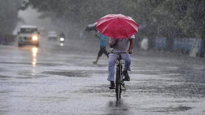
Odisha is set to experience continued heavy rainfall till July 12 due to a low-pressure system formed over Gangetic West Bengal and nearby areas, the India Meteorological Department (IMD) confirmed on Sunday.
Triggered by an active upper air cyclonic circulation, the system is expected to move slowly towards Jharkhand and northern Chhattisgarh over the next 2–3 days, intensifying rain activity in northern and western Odisha.
The IMD’s regional centre in Bhubaneswar has issued red, orange, and yellow alerts across multiple districts, warning of heavy to extremely heavy rain, thunderstorms, and gusty winds in the coming days.
Monday Forecast and Districts on Alert:
-
Very heavy rain is likely in:
Keonjhar, Angul, Deogarh, Sambalpur, Sundargarh, Jharsuguda, Bargarh, Nuapada -
Heavy rain may affect:
Bolangir, Subarnapur, Boudh, Kandhamal, Kalahandi, Nayagarh, Cuttack, Dhenkanal -
Thunderstorms with lightning and 40 km/h winds are forecasted in:
Balasore, Bhadrak, Jajpur, Kendrapara, Jagatsinghpur, Deogarh, Mayurbhanj
Authorities have been advised to stay alert, especially in flood-prone and low-lying areas, and ensure emergency teams are on standby.
Weather System Details:
The IMD noted that the cyclonic circulation extends up to 7.6 km above mean sea level, tilting southwestward with height. This has caused intense cloud development over the North and Eastcentral Bay of Bengal, feeding the ongoing rain activity.
Satellite images reveal deep convective clouds over a large portion of the Bay, supporting forecasts of unstable weather over Odisha for the next few days.
Ground Situation:
Reports from districts such as Jharsuguda, Sambalpur, and Sundargarh indicate rising water levels, waterlogging, and transport disruptions due to ongoing downpours. If rainfall continues at this pace, the flood-like conditions in some regions could worsen.
District administrations are on high alert as the monsoon system continues to impact daily life across the state.


