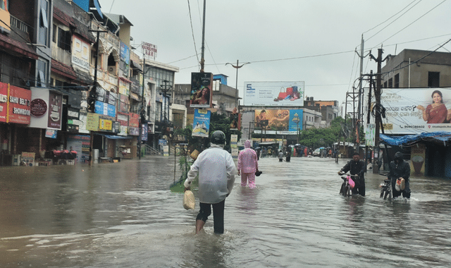
A fresh low-pressure area has formed over the northwest Bay of Bengal and adjoining regions, setting the stage for intense monsoon activity across Odisha. Regional Meteorological Centre Director Dr. Manorama Mohanty confirmed that the system will trigger heavy to very heavy rainfall over large parts of the state for the next two to three days.
The India Meteorological Department has issued a specific warning for August 24 and 25, expecting widespread very heavy showers. Rainfall intensity is likely to ease from Wednesday, August 26, though isolated heavy spells could return around August 28. Interior, northern, and western districts remain under watch until August 29.
Coastal waters will stay rough to very rough until August 25. Strong winds of 30–40 kmph are expected along the Odisha coast, prompting the IMD to strictly advise fishermen against venturing into the sea. District administrations have been urged to take necessary precautions and ensure fishing communities stay informed.
The past 24 hours already delivered extreme rainfall. The highest total was recorded at TH Rampur in Kalahandi district – a staggering 345 mm (34.5 cm). Other notable figures include 212 mm at Kashipur (Rayagada), 200 mm at Jayapatna (Kalahandi), 190.6 mm at Sadasar (Nabarangpur), and several other stations crossing 140–189 mm. Nearly 21 towns reported heavy to very heavy rain, with most parts of the state witnessing significant downpours.
For Monday, an orange warning has been issued for Sundaragada, Jharsuguda, Baragada, Sambalpur, Sonpur, and Boudh districts, flagging the risk of very heavy rain accompanied by thunderstorms and winds of 50–60 kmph. Sixteen other districts are under yellow alert for heavy rain, thunder, and 30–40 kmph winds. Coastal areas may see relatively lighter activity on Tuesday compared with the interior districts.
Authorities have appealed to residents to remain vigilant, follow official advisories, and avoid unnecessary travel in flood-prone zones. With the monsoon still active, Odisha continues to experience the full force of the season’s late-August intensity.