
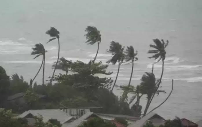
Odisha is gearing up for three days of intense rainfall, with a low-pressure system forming over the Bay of Bengal expected to strengthen within the next 48 hours.
The India Meteorological Department (IMD) has issued warnings for heavy to very heavy rainfall across southern and northern Odisha until August 16, with coastal districts likely to face the brunt of the weather system.
A low-pressure trough stretching from south Bihar to north Odisha, coupled with a cyclonic circulation extending from the central Bay of Bengal to the West Bengal coast, is driving this weather event. The system, active between 3.1 km and 5.8 km above sea level, is set to intensify into a more potent low-pressure area by August 13, potentially escalating further. According to Manorama Mohanty, Director of the Regional Meteorological Centre, Bhubaneswar, this could lead to widespread rainfall, with some areas experiencing extremely heavy downpours.
The past 24 hours have already seen significant rainfall deficits, with the state recording 80% less rainfall than normal. However, isolated areas like Pattamundai in Kendrapara district reported 7.03 cm of rain, while heavy showers were noted in Kandhamal, Gajapati, Jagatsinghpur, Puri, Ganjam, and Koraput. From Wednesday to August 16, rainfall is expected to exceed normal levels, particularly in southern districts.
An orange warning has been issued for Malkangiri and Koraput, signalling a high risk of heavy rainfall. A yellow warning for thunderstorms and rain extends to districts like Ganjam, Gajapati, Rayagada, Kalahandi, Balangir, Nuapada, Nabarangpur, Balasore, Bhadrak, Jajpur, Kendrapara, Cuttack, Jagatsinghpur, Puri, Khordha, Nayagarh, Sundargarh, Jharsuguda, Bargarh, Sambalpur, Deogarh, Angul, Dhenkanal, Keonjhar, Mayurbhanj, Sonepur, Boudh, and Kandhamal. Fishermen have been advised to avoid venturing into deep seas until August 16 due to rough conditions.
Since June 1, Odisha has recorded 655.9 mm of rainfall, 6% below the normal 698.4 mm. The rainfall deficit has widened since August 1, but the incoming system is expected to reverse this trend temporarily. Authorities are urging residents to stay vigilant, with preparations underway to mitigate potential flooding and disruptions in vulnerable areas.


