
Air quality across the National Capital Region (NCR) reached catastrophic levels on Friday morning, November 6, 2026, ahead of the Dhanteras and Diwali weekend.
An analysis of Central Pollution Control Board (CPCB) data shows that Delhi’s Air Quality Index (AQI) officially entered the “Severe” band (407) at 6:00 AM IST across the same 39 ambient monitoring stations that were operational during last year’s Diwali.
While the CPCB’s official 24-hour rolling average smooths out rapid spikes—reading 391 (“Very Poor”) overall—an hourly breakdown by Hindustan Times reveals that every single hour since 8:00 PM on Thursday scored “Severe” across all 59 current monitoring stations. By 10:00 AM, the calculated single-hour citywide score surged to 453, indicating that official averages will continue climbing if stagnant weather persists.
Extreme PM2.5 Spikes and Meteorological “Thermal Lid”
Pollutants have built up rapidly over two consecutive still nights due to unfavorable micro-climatic conditions:
- Hazardous Fine Particulate Matter: At 10:00 AM, the median monitoring station logged 335 micrograms of PM2.5 per cubic metre—more than five times India’s national safe limit of 60 µg/m³, well past the CPCB severe threshold of 250 µg/m³. Over 70% of stations (41 out of 59) breached this line.
- Dead-Calm Ground Air: The India Meteorological Department (IMD) Safdarjung station reported virtually zero surface wind speed through Thursday night, blocking the horizontal dispersion of vehicular emissions and festive traffic exhaust.
- Shallow Atmospheric Boundary: A sharp thermal inversion created a low ceiling over the city. Normally, solar heating expands the boundary layer up to 1,300 meters; however, Friday’s layer remained compressed between 600 to 800 meters, packing citywide emissions into half the usual atmospheric volume.
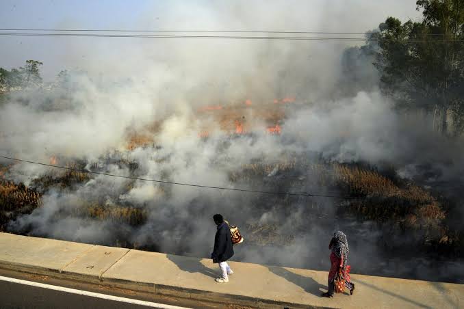
Fourfold Surge in Late-Afternoon Stubble Fires
A key factor driving the crisis is a sharp increase in farm fires across Punjab and Haryana, combined with upper-level wind patterns:
- INSAT-3DS Satellite Findings: Data from India’s geostationary satellite, INSAT-3DS—which scans the region every 30 minutes—showed that daily farm fires grew more than four and a half times between Sunday and Thursday, with almost all blazes lit between 4:00 PM and 6:00 PM.
- Blind Spot in 2 PM Counts: Traditional polar-orbiting NASA satellite passes occur around 2:00 PM IST, registering only a 60% rise (averaging 184 fires per day). This highlights that farmers are increasingly lighting fields late in the afternoon after standard satellite overpasses.
- Transport-Level Smoke Inflow: Transport-level winds at altitudes of 1,000 to 3,000 meters have blown continuously from the north-west at speeds up to 36 km/h, directly channeling dense agricultural smoke from Punjab and Haryana into the Delhi bowl.
With Dhanteras on Friday and Diwali falling on Sunday, environmental authorities warn that pre-festive traffic congestion and potential pyrotechnic emissions could worsen condition levels over the next 48 hours.