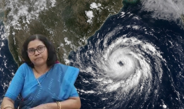
A Deep Depression over the Westcentral and adjoining Northwest Bay of Bengal has slowed to a crawling speed of 5 to 6 kmph, consolidating strength over open waters as it edges closer to the eastern coast of India.
The India Meteorological Department (IMD) confirmed that the system is under continuous surveillance by the Doppler Weather Radar at Visakhapatnam and is expected to cross the North Andhra Pradesh–South Odisha coastline between Visakhapatnam and Gopalpur, close to Kalingapatnam, as a Deep Depression by tonight, September 23, 2026.
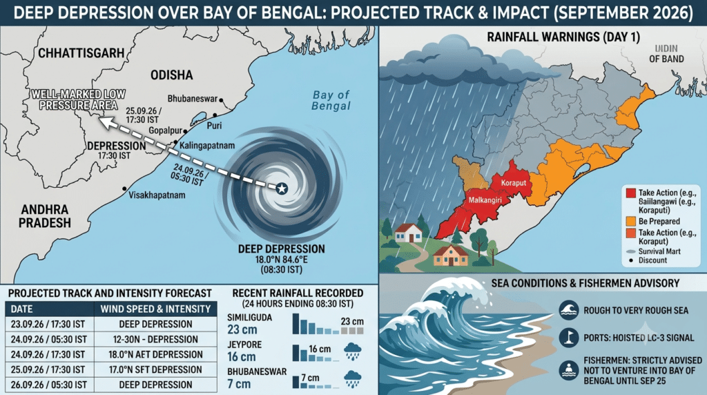
As of 08:30 IST today, the storm center was positioned near latitude 18.0°N and longitude 84.6°E—approximately 60 km southeast of Kalingapatnam (Andhra Pradesh), 140 km east-northeast of Visakhapatnam, 150 km south of Gopalpur (Odisha), and 240 km south-southwest of Puri.

Projected Track and Wind Intensity
The weather system carries maximum sustained surface wind speeds of 55 to 65 kmph, gusting up to 75 kmph along the coast. As it makes landfall and moves inland in a west-northwest direction, it is forecast to weaken into a Depression and eventually a Well Marked Low Pressure Area by September 26:
| Date / Time (IST) | Location (Lat °N / Long °E) | Wind Speed (Kmph) | System Category |
| 23.09.26 / 08:30 | 18.0 / 84.6 | 55–65 (gusting 75) | Deep Depression |
| 23.09.26 / 17:30 | 18.1 / 84.2 | 55–65 (gusting 75) | Deep Depression |
| 24.09.26 / 05:30 | 18.4 / 83.6 | 50–60 (gusting 70) | Deep Depression |
| 24.09.26 / 17:30 | 18.8 / 83.3 | 45–55 (gusting 65) | Depression |
| 25.09.26 / 05:30 | 19.3 / 83.1 | 45–55 (gusting 65) | Depression |
| 25.09.26 / 17:30 | 19.9 / 82.9 | 40–50 (gusting 60) | Depression |
| 26.09.26 / 05:30 | 20.5 / 82.8 | 30–40 (gusting 50) | Well-Marked Low-Pressure Area |
Torrential Rainfall Downpours Recorded
Heavy rain has already hit southern and coastal districts of Odisha. In the 24 hours ending at 08:30 IST today, Similiguda in Koraput district recorded a massive 23 cm of rainfall, followed by Jeypore (16 cm), Brahmapur (15 cm), Borigumma (14 cm), Tentulikhunti (14 cm), and Nandahandi (13 cm). Urban hubs including Baleshwar (13 cm) and Bhubaneswar (7 cm) have also witnessed rainfall.
Multi-Day Warning Levels Across Districts
The IMD has issued multi-day rainfall warnings across the region:
-
Day 1 (Valid to 08:30 IST, 24.09.26): Red Warning (Take Action) for Koraput, Malkangiri, Kalahandi, and Nabarangpur districts due to heavy to very heavy rainfall with isolated extremely heavy falls. An Orange Warning covers Nuapada, Balangir, Kandhamala, Rayagada, Gajapati, Ganjam, Puri, Khordha, Nayagada, Boudh, Sonepur, and Baragada.
-
Day 2 (Valid to 08:30 IST, 25.09.26): Red Warning remains active for Nabarangpur, while an Orange Warning covers Baragada, Nuapada, Balangir, Kalahandi, Koraput, and Malkangiri.
-
Days 3 & 4 (25.09.26 – 27.09.26): Orange Warnings persist for western and southern districts including Nuapada, Kalahandi, Nabarangpur, and Balangir as the system dissipates inland.
Maritime Alerts and Safety Directives
Sea conditions will remain rough to very rough over the west-central and northwest Bay of Bengal and along the Odisha, North Andhra Pradesh, and West Bengal coasts through September 24.
All major ports in Odisha have hoisted Local Cautionary Signal No. III (LC-3). Fishermen are strictly warned against entering the Bay of Bengal or venturing along the coastline until September 25.
Authorities caution against potential flash flooding, urban waterlogging, minor structural damage to kutcha homes, power outages, tree uprooting, and localised landslides in hilly terrain. Residents in affected zones are advised to stay indoors, close windows and doors, avoid shelter under trees, unplug electrical appliances, and monitor official weather bulletins closely.