
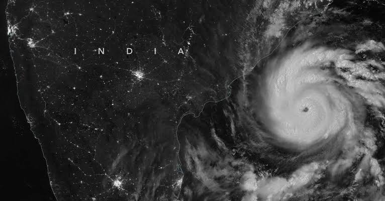
The India Meteorological Department (IMD) confirmed that Severe Cyclonic Storm Murasu successfully made landfall on the south Andhra Pradesh coast in the early hours of Tuesday, November 3, 2026. The storm system has since entered a weakening phase as it moves inland.
According to the IMD’s detailed bulletin, the severe cyclonic storm crossed the coastline between Nellore and Narasapur, passing close to Ongole, during a two-hour window from 03:30 AM to 05:30 AM IST today.
Landfall Intensity and Position
At the time of landfall, Murasu maintained sustained surface wind speeds of 100 to 110 kmph, with gusts peaking at 120 kmph near the core region.
As of the 05:30 AM observation, the storm lay centered over south coastal Andhra Pradesh, very close to Ongole. It was situated approximately:
- 40 km southwest of Bapatla
- 80 km north-northeast of Kavali
- 120 km west-southwest of Machilipatnam
- 130 km north of Nellore
IMD radar tracking indicated the system moved north-northwestwards with a sustained speed of 8 kmph during the six hours leading up to landfall.
IMD Weakening Forecast and Tracking
The national weather agency has predicted a rapid weakening trend for Murasu as it continues to interact with the terrain:
- Weakening Phase 1: Gradual weakening into a Cyclonic Storm is anticipated by noon today (November 3). During this phase, sustained winds will reach 80 to 90 kmph, gusting up to 100 kmph.
- Weakening Phase 2: Further dissipation into a Deep Depression is forecast by midnight (00:00 AM, November 4). Sustained wind speeds are expected to drop significantly to 55 to 65 kmph, gusting to 75 kmph.
The system remains under the continuous surveillance of Doppler Weather Radars stationed at Chennai and Machilipatnam to monitor real-time track and intensity changes.