
Odisha Leads India with 95% Completion of Forest Geo-Referencing Project
Odisha is on the verge of completing a groundbreaking geo-referencing project for its forest lands, a transformative initiative aimed at bolstering conservation, accelerating development, and resolving longstanding disputes.
With approximately 95% of the 60,000 square kilometres of forest land already geo-referenced, the project has positioned Odisha as a national leader in forest management. The Central Empowered Committee (CEC), constituted under the Supreme Court’s directives, lauded the state government’s remarkable progress during a review meeting held today.
The Odisha Forest Geo-Referencing project, spearheaded by the state’s Forest, Environment, and Climate Change Department, is designed to achieve multiple objectives. It ensures the protection of forest lands, safeguards the rights of tribal communities, facilitates the collection of non-timber forest produce by forest-fringe dwellers, and expedites developmental projects by clearly demarcating forest boundaries. Additionally, the initiative aims to resolve conflicts over forest land usage, which have historically delayed infrastructure and development activities.
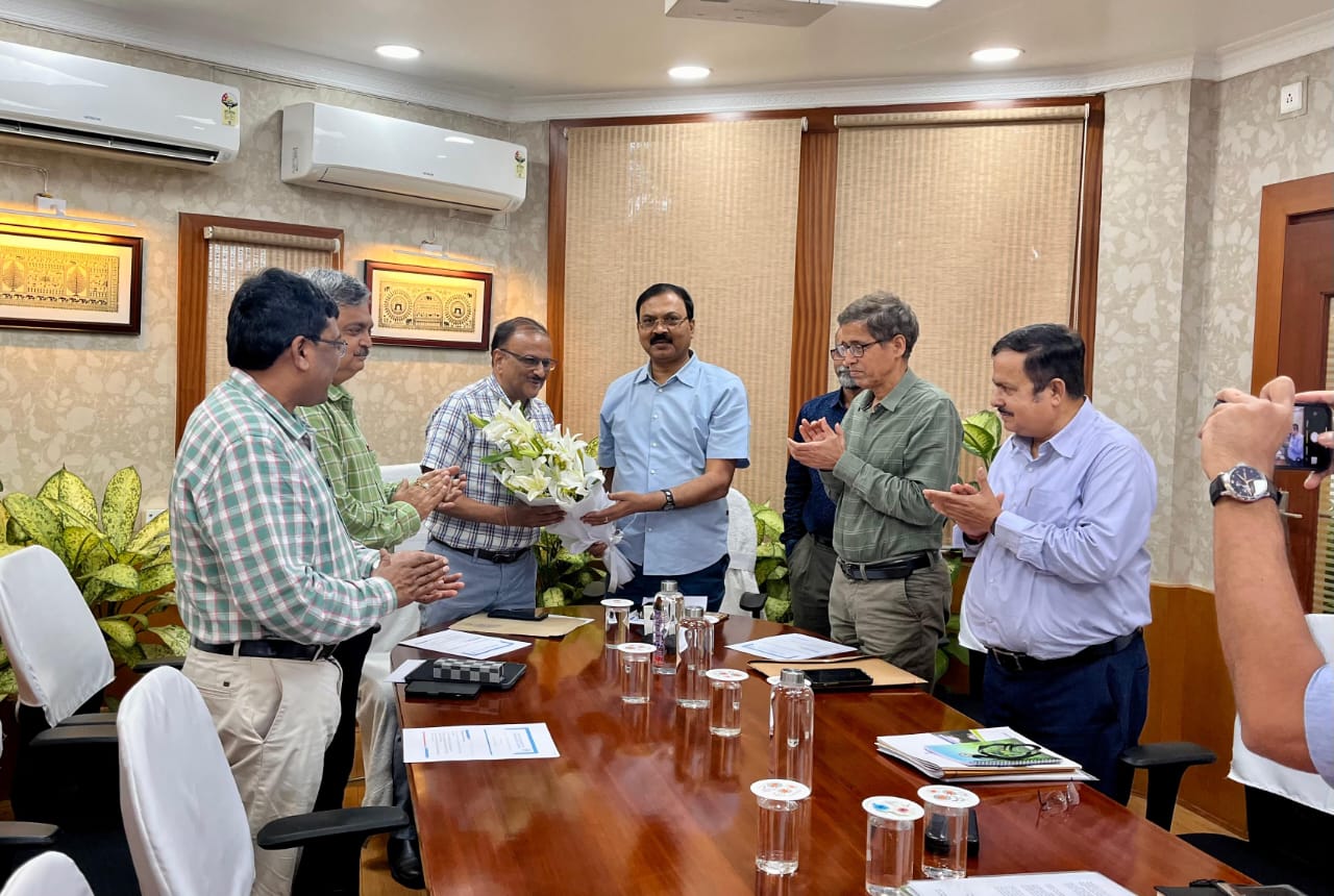
The review meeting, chaired by CEC Chairman Siddhanta Das, was attended by key state officials, including Additional Chief Secretary Satyabrata Sahu, Principal Chief Conservator of Forests Suresh Panth, Principal Chief Conservator of Wildlife Prem Kumar Jha, and Member Secretary of the State Pollution Control Board Smt. Uma Nanduri, Nodal Officer for the Forest Conservation Act, Dr. K. Murugesan, OSD Lingaraj Ota, and Departmental Director G. Rajesh. The meeting highlighted the project’s progress and its potential to serve as a model for other states.
Das described the project as “historic,” emphasising its role in streamlining Odisha’s development processes. “Odisha’s remarkable success in implementing this project places it at the forefront nationally. This model will be replicated across other states,” he said, commending the state government for its cooperation and efficiency. The project aligns with the Forest Conservation Act of 1980, which mandates central government approval for non-forest activities on forest land. Previously, the lack of accurate records often caused delays in developmental projects. Geo-referencing provides precise boundary demarcation, mitigating such challenges.
The project’s technical execution has been supported by the Spatial Planning and Analysis Research Centre, with its Managing Director, Subhadarshi Mishra, presenting critical data during the meeting. The initiative, undertaken under the guidance of the Union Ministry of Environment, Forest, and Climate Change, is nearing its final phase, with the remaining 5% of forest land expected to be geo-referenced soon.
Odisha Forest Geo-Referencing efforts have far-reaching implications. By ensuring accurate mapping, the state can protect tribal rights, prevent encroachments, and facilitate sustainable development. The project also enhances transparency in forest land management, reducing disputes and fostering collaboration between stakeholders.
As Odisha sets a benchmark for the nation, its geo-referencing model is poised to reshape forest governance across India.


