
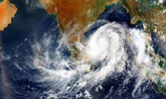
A low‑pressure system formed over the north Bay of Bengal near the West Bengal–Bangladesh coast on Wednesday morning is expected to intensify into a depression within 36 hours, according to the India Meteorological Department (IMD).
Officials said the system, triggered by an active upper‑air cyclonic circulation, will move northwestwards and cross the West Bengal–Bangladesh coast as a depression. Its impact is likely to strengthen the monsoon and bring widespread heavy to very heavy rainfall across Odisha until August 17.
The IMD has issued a red alert for Kendujhar district on Thursday, while Bhadrak and Balasore are under red alert for Wednesday. Orange warnings have been issued for Anugolal, Kendujhar, Jagatsinghpur, Kendrapada, Jajpur, Sundaragada, Jharsuguda, Baragada, and Sambalpur, while yellow alerts cover 20 other districts including Puri, Khordha, Mayurbhanj, Kataka, and Dhenkanal.
Wind speeds of 40–50 kmph, gusting up to 60 kmph, are expected along the Odisha coast between August 12–14, making the sea rough. Fishermen have been advised not to venture into the sea until August 14.
Regional IMD Director Manorama Mohanty said the system extends up to 7.6 km above sea level, and its influence will bring intense rainfall, thunderstorms, and gusty winds over the next five days. Authorities have warned of flooding, waterlogging, and landslides in low‑lying and hilly areas.
Residents across Odisha have been urged to remain vigilant as the monsoon system intensifies, with officials stressing preparedness to mitigate potential damage.