
As Odisha grapples with widespread dense fog causing traffic chaos and low visibility, weather experts have raised concerns about a brewing storm in the Bay of Bengal that could intensify into a cyclone by November 26.
While the government assures full preparedness regardless of the cyclone’s arrival, residents in coastal areas are on alert for possible heavy rains and strong winds.
The Regional Meteorological Centre in Bhubaneswar has forecasted that a well-marked low-pressure area over the Malacca Strait and south Andaman Sea will deepen into a depression within the next 24 hours. Moving west-northwest, it is expected to evolve into a depression over the southeast Bay of Bengal and adjoining south Andaman Sea today. By November 26, it could further intensify into a cyclone over the southeast Bay of Bengal.
From the evening of November 25, the storm’s impact may escalate in the deep sea, with wind speeds reaching 50-70 km/h in the southeast Bay of Bengal. By the morning of November 26, winds could gust up to 60-70 km/h, with peaks of 80 km/h in isolated areas. If it fully develops into a cyclone, maximum wind speeds may hit 100 km/h. Although the storm’s path remains uncertain, two weather systems currently in the Bay of Bengal could merge, potentially leading to a severe cyclone. However, no clear confirmation is available yet.
The potential cyclone is likely to bring heavy rainfall to the coasts of Andhra Pradesh, Puducherry, and Tamil Nadu, with Odisha expected to face lesser impacts. Fishermen have been strictly advised against venturing into deep waters.
Odisha Disaster Management Minister Suresh Pujari emphasised the government’s readiness, stating, “Whether the cyclone comes or not, we are fully prepared.” The system is currently about 1,000 km from the Odisha coast, and further preparations will be based on updates after November 25. Pujari noted that Tamil Nadu might bear the brunt more than Odisha.
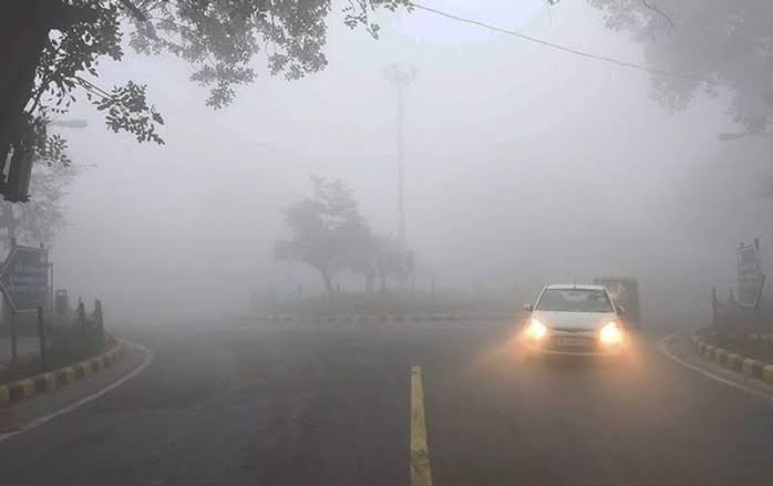
Compounding the weather woes, dense fog has blanketed the state due to a high-pressure system, severely disrupting daily life. Six districts—Sundargarh, Koraput, Dhenkanal, Khordha, Jagatsinghpur, and Ganjam—are experiencing thick fog, with visibility dropping to zero up to 100 meters in some areas. In the twin cities of Cuttack and Bhubaneswar, morning fog has made commuting hazardous, forcing vehicles to use headlights even during the day. Schoolchildren and early commuters are particularly affected.
The iconic Konark Sun Temple was shrouded in fog this morning, appearing invisible in the misty veil. Fewer tourists visited, but those who did enjoyed the ethereal atmosphere. Roads across the state are fog-covered, leading to stalled traffic on national highways. Large vehicles like trucks and buses have been parked with lights on, unable to proceed safely due to poor visibility. In extreme cases, faces are barely visible even at close range.
Met scientist, Sanjeev Dwivedi, predicts dry weather for the next seven days with no rain expected. Night temperatures in coastal Odisha remain under the influence of the fog blanket.
Authorities urge caution on roads and advise residents to stay updated on weather alerts as the dual threats of fog and the potential cyclone loom over the region.


