A cyclonic circulation currently lies over the northern Bay of Bengal, adjacent to the coasts of West Bengal and north Odisha, extending up to 5.8 km above mean sea level and tilting southwestward with height. Under its influence, a low-pressure area is likely to develop over the same region within the next 24 hours, triggering active monsoon conditions across Odisha.
The monsoon trough at mean sea level now extends from Bikaner to the northeast Bay of Bengal via Gwalior, Banda, Sidhi, Jamshedpur, and Digha, with an upward extension of up to 3.1 km. A separate trough from central East Rajasthan to the cyclonic circulation zone over the Bay of Bengal has merged with the main monsoon trough, intensifying weather activity in the region.
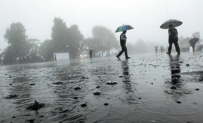
In the past 24 hours, Odisha witnessed significant rainfall, with the highest amounts recorded in Th Rampur (Kalahandi) at 7 cm, Kantapada (Cuttack) 6 cm, and multiple areas including Keonjhargarh, Nayagarh, Mayurbhanj, and Sundargarh receiving 5 cm each. Other regions like Kandhamal, Dhenkanal, Sambalpur, Bhadrak, and Ganjam also received widespread showers.
Weather Warnings and Forecast:
Day 1 (Till 8:30 AM, July 14)
-
Orange Warning: Heavy to very heavy rainfall with thunderstorms and gusty winds (30-40 kmph) at isolated places in Sundargarh, Mayurbhanj, Keonjhar.
-
Yellow Warning: Heavy rainfall in Balasore, Bhadrak, Jajpur, Kendrapara, Angul, Dhenkanal, Deogarh, Cuttack, Nayagarh, Kalahandi, Koraput, Rayagada, Sambalpur and thunderstorms in Jagatsinghpur, Jharsuguda, Bargarh, Puri, Khurda, Ganjam, Gajapati.
Day 2 (July 14–15)
-
Orange Warning: Very heavy rainfall in Sundargarh, Sambalpur, Jharsuguda, Bargarh.
-
Yellow Warning: Heavy rainfall in Mayurbhanj, Keonjhar, Angul, Dhenkanal, Cuttack, Nayagarh, Boudh, Sonepur, Deogarh, Bolangir, Kandhamal, Kalahandi. Thunderstorms expected in coastal and interior districts.
Day 3 (July 15–16)
-
Yellow Warning: Heavy rain likely over Sundargarh, Jharsuguda, Bargarh, Sambalpur. Thunderstorm alerts for Balasore, Bhadrak, Jajpur, Kendrapara, Cuttack, Jagatsinghpur, Deogarh, Angul, Dhenkanal, Keonjhar, Mayurbhanj.
Day 4 (July 16–17)
-
Yellow Warning: Heavy rainfall expected in Sundargarh, Jharsuguda, Sambalpur. Thunderstorms and lightning anticipated across several coastal and northern districts.
Day 5 (July 17–18)
-
Yellow Warning: Heavy rain forecast for Mayurbhanj, Keonjhar, Sundargarh with widespread thunderstorms likely across Balasore, Bhadrak, Jajpur, Kendrapara, Cuttack, Jagatsinghpur, Jharsuguda, Bargarh, Deogarh, Angul, Dhenkanal, Sambalpur.
Likely Impacts and Safety Advisory:
The approaching system may cause:
-
Damage to plantations, crops, kutcha houses, and power lines.
-
Uprooting of trees and snapping of branches.
-
Flooding in urban low-lying areas, road blockages, and traffic disruptions.
-
Landslides or mudslides in hilly or vulnerable areas.
Public is advised to:
-
Stay indoors during storms, avoid sheltering under trees.
-
Unplug electrical appliances and avoid water bodies.
-
Follow traffic advisories and avoid flood-prone areas.
-
Move to safer locations if in vulnerable structures.
Authorities are monitoring developments closely and have advised residents in high-risk districts to remain vigilant for the next few days.


