

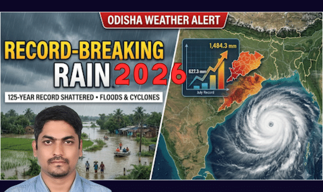
Challenging conventional meteorological predictions, Odisha has recorded historic, record-breaking rainfall this year, defying the typically dry conditions associated with a strong El Niño phenomenon.
According to India Meteorological Department (IMD) scientist Dr. Umashankar Das, the state witnessed a staggering 29% surplus rainfall during the core monsoon season (June–September) and an unprecedented 45% surplus during the post-monsoon period (October to November 21), bringing severe floods in July–August and cyclonic devastation in November.
A Historic Monsoon Surge
While Odisha normally receives between 1,100 mm and 1,200 mm of rain during the monsoon season, this year’s cumulative rainfall reached 1,484.3 mm—making it the fifth-highest monsoon rainfall on record for the state. The only years to surpass this figure were 1994 (1,621.6 mm), 1961 (1,542.1 mm), 2006 (1,508.8 mm), and 1956 (1,499.5 mm).
The standout anomaly occurred in July, which saw a massive 627.3 mm of rainfall. This crossed the all-time highest record. Four consecutive cyclonic circulations over the Bay of Bengal fueled this deluge, followed by four more systems in August that brought 432.4 mm of rain—trailing only historic August highs from 1907 (531.8 mm), 1926 (526.3 mm), and 2021 (511 mm).
Even September, which typically sees tapering rainfall, recorded a heavy 314 mm. Following a deficit in June, the relentless back-to-back downpours from July to September pushed rivers past danger marks, submerging farmlands during peak agricultural activity and compounding losses for farmers.
Post-Monsoon Cyclones Batter South Odisha
The wet spell refused to subside after the monsoon’s withdrawal. Back-to-back cyclonic systems—Arnav, Murasu, and Akvan—dumped torrential rain across Odisha, Andhra Pradesh, and Chhattisgarh throughout October and November.
Southern Odisha bore the brunt of the post-monsoon fury:
- Ganjam District recorded a staggering 139% surplus in November, receiving 568.3 mm of rain against its usual monthly average of 180–200 mm.
- Gajapati District logged 456.4 mm of rainfall, marking a 112% surplus above normal.
How Odisha Beat the El Niño Odds
Explaining the meteorological paradox, Dr. Das noted that El Niño typically warms the Indian Ocean and creates unfavorable conditions for cyclone formation by weakening storm remnants moving in from the South China Sea. However, intense equatorial atmospheric wave activity—specifically Kelvin waves, Rossby waves, and the Madden-Julian Oscillation (MJO)—combined with elevated sea surface thermal energy, overrode the El Niño suppression to trigger frequent low-pressure areas and cyclones.
Dr. Das pointed out that while rare, historical precedents exist: strong El Niño years in 1976 and 1987 saw four and three cyclones respectively in the October–November window, all making landfall along the Andhra coast. This year’s atmospheric dynamics mirrored those anomalies, turning a predicted dry spell into one of Odisha’s wettest and most turbulent weather years in over a century.