
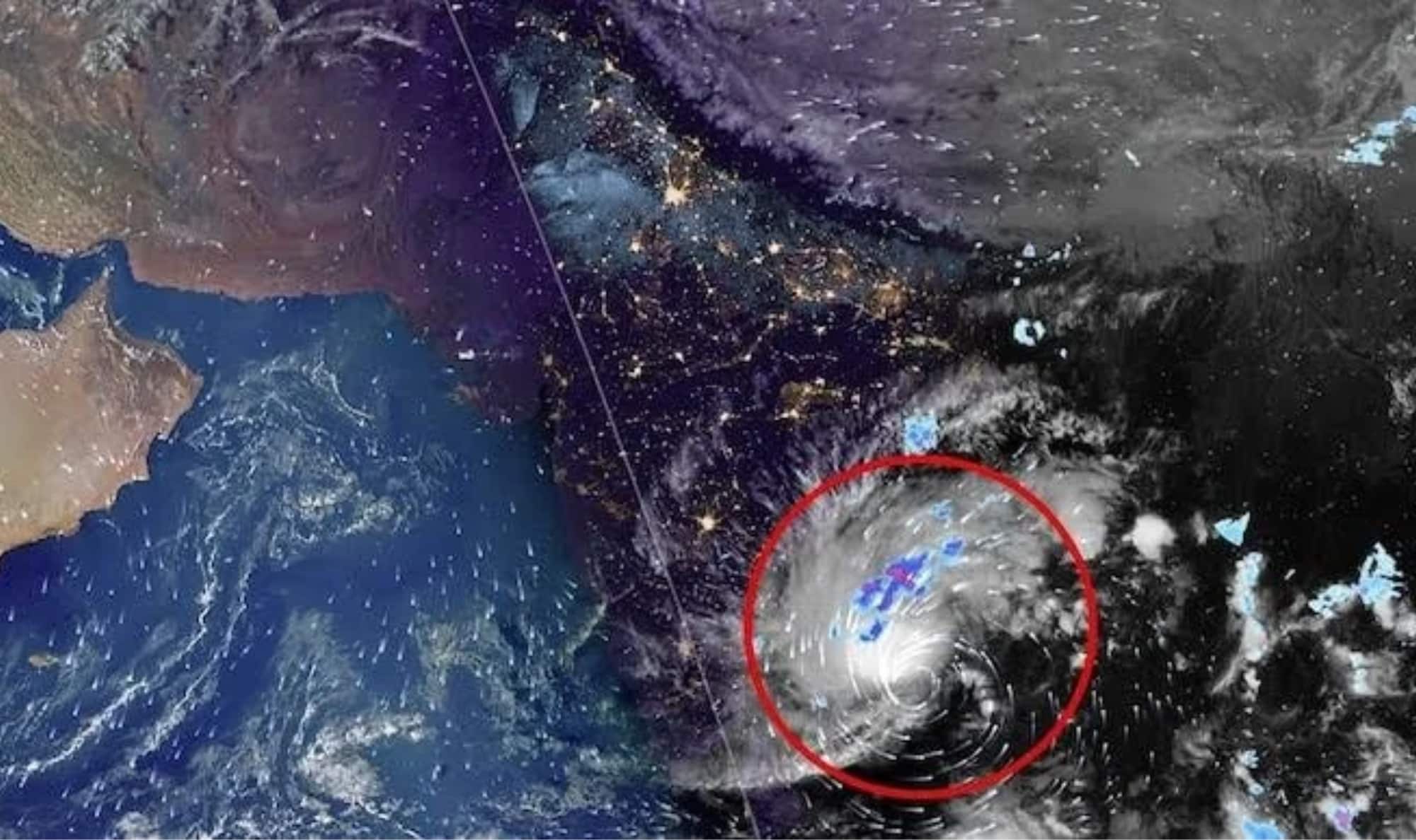
Coastal districts across North Andhra Pradesh and South Odisha have been placed on heightened alert after the India Meteorological Department (IMD) revised the projected trajectory of Severe Cyclonic Storm ‘Akvan’.
According to the latest meteorological bulletin issued on Wednesday, the system is now expected to cross the coast between Narsapur in Andhra Pradesh and Puri in Odisha around noon on Friday, November 20.
Currently churning over the central parts of the South Bay of Bengal and the adjoining Westcentral Bay of Bengal, Cyclone ‘Akvan’ is tracking north-northwestwards steadily. At the time of the latest observation, the weather system lay centered approximately 570 km east of Chennai, 580 km south-southeast of Visakhapatnam, and 590 km southeast of Machilipatnam. Further north along the eastern seaboard, the storm was positioned roughly 710 km south of Gopalpur and 770 km south of Puri.
Meteorologists project that ‘Akvan’ will maintain its north-northwestward trajectory over the next 48 hours before making landfall along the North Andhra Pradesh–Yanam and South Odisha coastlines. As the severe cyclonic storm makes landfall around noon on November 20, it is forecast to unleash maximum sustained wind speeds of 90–100 kmph, with intense gusts reaching up to 110 kmph.
The updated forecast represents a notable northward shift in the storm’s expected landfall zone. Earlier IMD projections had indicated that the cyclone would cross the Andhra Pradesh and Yanam coasts further south, between Nellore and Visakhapatnam. With the revised track bringing Puri into the direct landfall window, emergency response teams and disaster management authorities in Odisha—particularly across Ganjam, Gajapati, Khordha, and Puri districts—are ramping up precautionary measures alongside their counterparts in Andhra Pradesh.