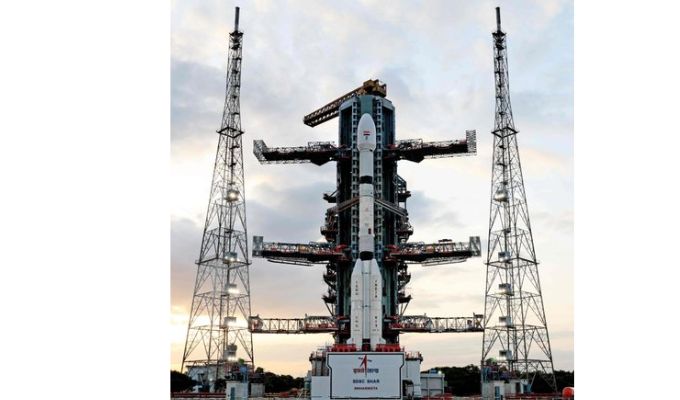
The NASA-ISRO Synthetic Aperture Radar (NISAR) satellite is scheduled to launch today at 5:40 PM IST from the Satish Dhawan Space Centre, aboard ISRO’s GSLV rocket.
Jointly developed by the United States and India, NISAR is poised to monitor Earth’s land and ice surfaces with unprecedented precision. Equipped with a massive 12-meter antenna, the truck-sized satellite will orbit at 747 kilometres above Earth, scanning its surface every 12 days.
Using advanced L-band and S-band radar systems, NISAR will capture vertical shifts as small as one centimetre—allowing scientists to track earthquakes, landslides, glacial melting, and deterioration in man-made structures.
“This is the most sophisticated radar we’ve ever built,” said Karen St. Germain, NASA’s Earth Science director. The mission, launched during the Trump-Modi era, reflects deep cooperation across continents, with NASA investing $1.2 billion and ISRO contributing $90 million.
Integration of components from both nations took place at ISRO’s testing facility in Bengaluru. The satellite’s real-time data will assist researchers in predicting natural and human-induced hazards and improve disaster preparedness worldwide.
NISAR not only signals an era of advanced geospatial mapping but also strengthens the strategic bond between two of the world’s leading space agencies.


