Super Typhoon Hinnamnor: Here’s All You Need To Know About 2022’s Strongest Global Storm
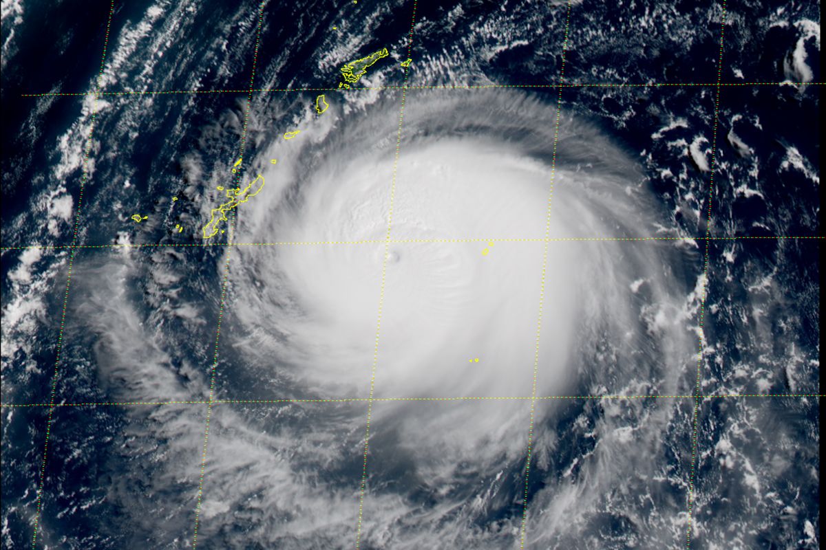
Beijing: Super Typhoon Hinnamnor is now the strongest global storm of 2022. Currently, it is moving across the East China Sea, threatening the southern islands of Japan and China’s east coast
According to the US Joint Typhoon Warning Center, Super Typhoon Hinnamnor is currently packing sustained winds of about 160 miles (257 kilometers) per hour and has gusts over 195 miles per hour.
The Hong Kong Observatory said at 10 a.m the typhoon was centered about 230 kilometres east of Japan’s Okinawa and is forecast to move west-southwest at about 22 kilometers per hour toward the Ryukyu Islands.
The US JTWC forecasts that the meandering super typhoon will lose some of its strength over the coming days.
Forecasts show the typhoon moving south of Okinawa by 2nd of September, then moving northward to approach the island over the weekend. After that the path is uncertain, but projections indicate the storm will continue north toward the Korean peninsula next week, suggesting it will bypass Taiwan and the coast of mainland China.
Following this, several flights have been already cancelled. Japan Airlines Co. cancelled flights to and from the region Wednesday, while ANA Holdings Inc. said eight flights have been scrubbed through Thursday. Both companies warned that depending on the course of the typhoon, flights could be affected throughout the week.
Comments are closed.