Bhubaneswar: The India Meteorological Department’s (IMD) regional centre here has issued red warning of heavy rainfall for four districts of the State.
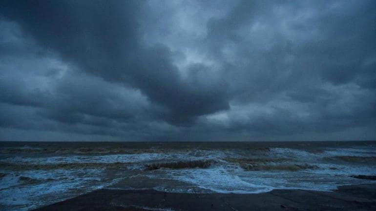
According to the IMD’s latest bulletin, the Depression over Northwest & adjoining Northeast Bay of Bengal moved west-northwestwards during past 03 hours with a speed of 20 kmph and lay centered at 0830 hrs IST of today, the 19th August 2022 over northwest & adjoining northeast Bay of Bengal near latitude 20.8°N and longitude 89.2°E, about 250 km east-southeast of Balasore (Odisha), 190 km east-southeast of Digha (West Bengal) and 150 km southeast of Sagar Islands (West Bengal).
“It is very likely to move west-northwestwards and intensify into a Deep Depression during next 06 hours. Continuing to move in the same direction, it is likely to cross West Bengal and Odisha coasts between Balasore & Sagar Islands around evening of today the 19th August, 2022. After landfall, it would continue to move west-northwestwards across north Odisha, West Bengal and Jharkhand towards north Chhattisgarh and weaken gradually,” said the IMD.
Under its influence, several districts will witness extremely heavy rainfall.
Forecast:
Day-1 (Valid upto 0830 Hrs IST of 20.08.22):
Light to moderate rain or thundershower very likely to occur at most places over the districts of Odisha.
Red warning (Take action)
Heavy to very heavy rainfall (7 to 20 cm) at a few places with isolated extremely heavy falls (>20cm) very likely to occur over the districts of Keonjhar, Bhadrak, Balasore and Mayurbhanj.
Orange warning (Be prepared)
Heavy to very heavy rainfall (7 to 20cm) very likely to occur at a few places over the districts of Kendrapada, Jagatsinghpur, Cuttack, Dhenkanal, Angul, Deogarh, Sundargarh, Sambalpur, Sonepur, Boudh, Bolangir, and Jajpur.
Yellow Warning (Be updated)
Heavy rainfall (7 to 11cm) very likely to occur at isolated places over the districts of Jharsuguda, Bargarh, Kalahandi, Kandhamal, Nuapada, Ganjam, Nayagarh, Khordha, Rayagada, Gajapati, Nawarangpur, Koraput, Malkangiri and Puri
Day-2 (Valid from 0830 Hrs IST of 20.08.22 to 0830 Hrs IST of 21.08.22):
Light to moderate rain or thundershower very likely to occur at most places over the districts of north Odisha and at many places over the districts of south Odisha.
Orange warning (Be prepared)
Heavy to very heavy rainfall (7 to 20cm) very likely to occur at one or two places over the districts of Jharsuguda, Sundargarh, Keonjhar, Deogarh, Sambalpur, Bargarh, Sonepur and Bolangir
Yellow Warning (Be updated)
Heavy rainfall (7 to 11cm) very likely to occur at isolated places over the districts of Mayurbhanj, Angul, Boudh, Kalahandi, Nuapada, Dhenkanal and Nawarangpur.
Day-3 (Valid from 0830 Hrs IST of 21.08.22 to 0830 Hrs IST of 22.08.22):
Light to moderate rain or thundershower very likely to occur at many places over the districts of north interior Odisha and at a few places over the rest districts of Odisha.
Comments are closed.